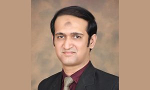
A.W.Mir
Professional Engineer & Chartered Land Surveyor
Chief Executive
Geomatics And Engineering Services (Pvt.) Ltd.,
Around the end of 18 century and early days of the nineteen century maps were mainly used as a tool for military purposes on our sub-continent to the extent that natives (Indians of all casts) were barred from training and employment in the profession of surveying & mapping. With passage of time when British commenced the massive task of Great Trigonometric Survey (GTS) of the whole subcontinent there was urgent need for trained survey and mapping manpower. GTS was at that time a great scientific undertaking never attempted or carried out in the history of mankind. The men involved in that endeavor were indeed heroes both native and foreigners – considering the mammoth size of the project and difficulties / hardships they endured in the field with no means of mechanical transport as is available to the present day survey professionals. It was all foot work in unchartered territories with large team of porters (Kolis) and other variety of helpers. Sickness due to Malaria and water borne diseases were common and caused great many deaths of the individuals. I, as a professional salute them for their efforts and scarifies that they made. We, even to this day, are benefiting from their hard work. I shall not hesitate in requesting Surveyor General of Pakistan to construct a Memorial Monument to honor all those early surveyors from our part of the subcontinent, who laid their lives in the course of their duty in the wild.
The survey data and maps produced there from was classified technical information accessible only to trust worthy government officials and natives were kept as far away as possible from the maps which they had contributed to produce. Something unfortunate but that was the way rulers of the time considered it fit to apply.
Then came 1947 and the subcontinent was partitioned into two countries – Pakistan and India. But we religiously stuck to the same old rules, regulations and restrictions in both the countries. General public were denied access to the survey data and maps for one security reason or another. Thank you Sahib Bahadar – Goora Sahib is replaced by Kala Sahib in all walks of life. What a fate for poor Kalay ordinary citizens – a lot can be said and written about what Kala Sahibs did to their countrymen but it is not the objective of this article. This has been mentioned in passing.
The advent of satellite based remote sensing and global positioning system (GPS) has brought about a major change to the whole concept of secrecy associated with the survey data and maps. In many developed countries national survey departments have shrunken in size to merely a few dozen men and women – national survey control networks abandoned and public told to go and use GPS data as and when they need – U.K. is a good example to quote, it is the same Goora Sahib who imposed all sorts of restrictions on the survey data and maps when they were here on subcontinent. We continued to follow their legacy but when they changed things in their own country, we dare not follow them, except when they come once again as World Bank highly paid advisors and tell us to change. I pray to Allah that they soon come and put things in their true perspective of present age and time.
Photogrammetry had been a very powerful technology to produce accurate maps for general purposes and projects related all over the world including Pakistan. Outer space exploration gave rise to Satellite Imagery and GPS. In the early days of satellite imagery resolution was poor but now it is down to half a meter or even less. From earlier 2D imagery now we can get (3D) stereo imagery similar to what we did in Photogrammetry – what a change. It is competitive cost and time wise.
Satellite Imagery is a very powerful technology for all types of professional; e.g. environmentalists, geologists, engineers, mapping establishments, climate change experts, agriculturists, water resources experts, disaster management personnel, foresters, etc.
One can get / buy high resolution satellite imagery of any part of our country but one cannot get 1:50,000 maps of all the areas – you ask the controlling agency – our Survey of Pakistan (SOP) and the answer comes, they are classified. What classified?
How strange, one can access GOOGLE Earth available free of cost to anyone with Internet access on his / her computer or even on cell phones. All our sensitive defense related sites (e.g. airports, harbors, ordinance factories, cantonments, sensitive offices and the list can go on) are much larger than the a meter square, the smallest object that one can see on the GOOGLE Earth or high resolution satellite imagery readily available off the shelf.
On the tail of high resolution satellite imagery comes the scanner based technology – LiDAR – it is made up of; Laser + Receiver System = Lidar (Light Detection and Ranging). It is free of day and night restrictions. Scanner takes millions of points per second. It comes vehicle mounted and can be mounted in light aircrafts and even unmanned aerial vehicles (UAVs), or on large drones.
This technology can be particularly effective for transmission lines projects in the mountainous areas of northern Pakistan, for railways in areas of Balochistan where terrestrial surveying techniques for security reasons cannot be used plus the fact that it is cheaper and quicker and more accurate. It goes without saying that quality design and accurate project quantities are directly related to quality of field survey data.
There is urgent need for our concerned agencies / departments to review and revise their age old obsolete rules / regulations governing survey control data and maps and move into 21st century. Allow usage of scanner based instruments mounted in light aircrafts, drones, and UAVs to all and everyone.


