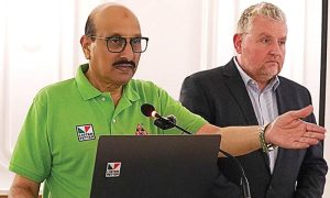
Pakistan took a decisive leap towards technological sovereignty and economic transformation today as leading consultancy VTT Global (Private) Limited finalised a high-level strategy workshop with the Space & Upper Atmosphere Research Commission (SUPARCO) for the nation’s landmark remote sensing satellite project.
This ambitious initiative, meticulously designed through VTT’s multidisciplinary approach, promises to unlock profound impacts across Pakistan’s core national priorities. The satellite is positioned to revolutionise economic resilience, fiscal planning, domestic space innovation, and crucially, ensure data sovereignty by reducing dependence on foreign systems. It stands as a cornerstone for anchoring Pakistan firmly within the emerging global geospatial ecosystem.
“The project integrates vital legal, financial, and technical frameworks,” stated a VTT representative, “ensuring strategic alignment with Pakistan Vision 2025, the National Space Policy 2023, and the UN Sustainable Development Goals.” Based on innovative public-private partnership models, robust investment mechanisms, and clear regulatory pathways, the satellite’s vast potential extends far beyond space.
Access to real-time, high-resolution satellite data will deliver tangible benefits nationwide. Key sectors set for transformation include agricultural optimisation for food security, enhanced climate adaptation strategies, bolstered national security, smarter urban planning, and significantly improved disaster risk management capabilities.
Ultimately, the project aims to catalyse entrepreneurial advancement and drive long-term economic sustainability. By building sovereign geospatial intelligence capabilities, Pakistan is poised to cultivate a self-sustaining, space-enabled knowledge economy, directly contributing to future GDP growth and securing its technological future.